Image:O'Hare International Airport (USGS) Phase3.png
Un article de Wikipédia, l'encyclopédie libre.
Taille de cet aperçu : 600 × 600 pixels
Image en plus haute résolution (1 132 × 1 132 pixels, taille du fichier : 2,12 Mio, type MIME : image/png)
| | Ce fichier provient de Wikimedia Commons?. Les informations le concernant sont affichées ci-dessous (procédure). |
| Description |
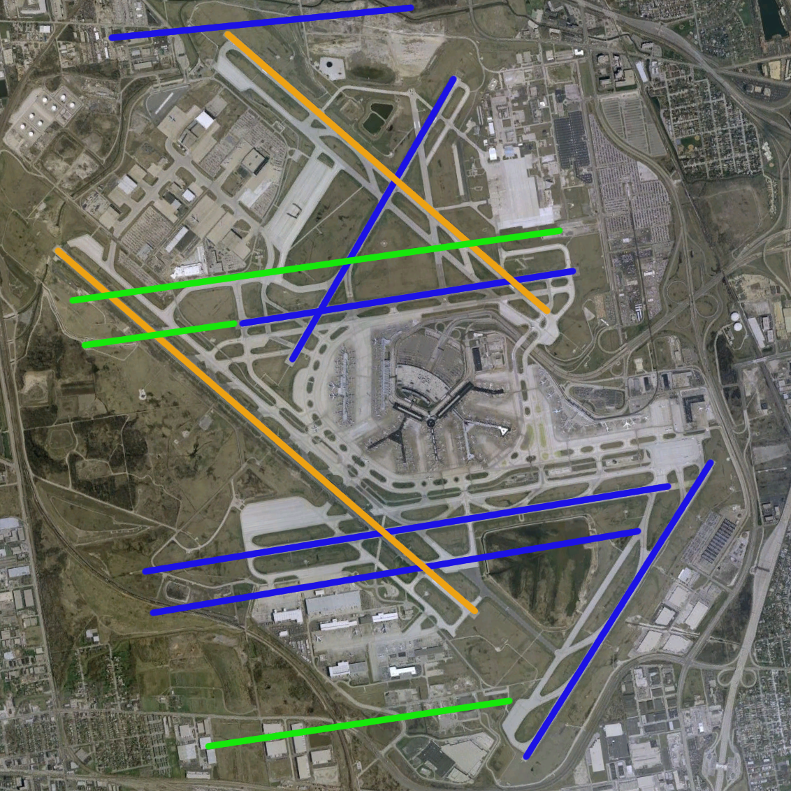
O'Hare International Airport modernization program - phase 3 runway configuration (blue = existing, green = new, orange = removed) |
|||
|---|---|---|---|---|
| Source |
NASA World Wind Screenshot, USGS urban ortho; [1] |
|||
| Date | ||||
| Author |
|
|||
| Permission (Reusing this image) |
see below |
|||
| Other versions | Image:O'Hare International Airport (USGS).png, Image:O'Hare International Airport (USGS) Current.png, Image:O'Hare International Airport (USGS) Phase1.png, Image:O'Hare International Airport (USGS) Phase2.png, Image:O'Hare International Airport (USGS) Final.png |
Historique du fichier
Cliquer sur une date et une heure pour voir le fichier tel qu’il était à ce moment-là
| Date et heure | Dimensions | Utilisateur | Commentaire | |
|---|---|---|---|---|
| actuel | 30 juin 2007 à 23:49 | 1 132×1 132 (2,12 Mio) | Brianski | (optimized, de-interlaced) |
| 14 mai 2006 à 11:58 | 1 132×1 132 (2,55 Mio) | Wangi | ({{Information| |Description=O'Hare International Airport modernization program - phase 3 runway configuration (blue = existing, green = new, orange = removed) |Source=NASA World Wind Screenshot, USGS urban ortho; [http://egov.cityofchicago.org/city/we) |
Pages contenant l’image
La page ci-dessous contient cette image :


_Phase3.png)