Image:Navy Island map.png
Un article de Wikipédia, l'encyclopédie libre.
Pas de plus haute résolution disponible.
Navy_Island_map.png (478 × 600 pixels, taille du fichier : 174 Kio, type MIME : image/png)
| | Ce fichier provient de Wikimedia Commons?. Les informations le concernant sont affichées ci-dessous (procédure). |
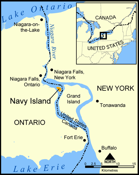
A map showing the location of Navy Island in the Niagara River. The nearby Grand Island is also shown, as are the towns of Niagara Falls, Niagara-on-the-Lake, Tonawanda, Buffalo, and Fort Erie.
Created by NormanEinstein, May 11, 2005.

Historique du fichier
Cliquer sur une date et une heure pour voir le fichier tel qu’il était à ce moment-là
| Date et heure | Dimensions | Utilisateur | Commentaire | |
|---|---|---|---|---|
| actuel | 19 mai 2005 à 16:32 | 478×600 (174 Kio) | NormanEinstein | |
| 11 mai 2005 à 22:05 | 683×740 (116 Kio) | NormanEinstein | (A map showing the location of Navy Island in the Niagara River. The nearby Grand Island is also shown, as are the towns of Niagara Falls, Niagara-on-the-Lake, Tonawanda, Buffalo, and Fort Erie. Created by NormanEinstein. {{PD-self}}) |
Pages contenant l’image
La page ci-dessous contient cette image :

