Image:National Atlas Louisiana east detailed.gif
Un article de Wikipédia, l'encyclopédie libre.
Pas de plus haute résolution disponible.
National_Atlas_Louisiana_east_detailed.gif (490 × 600 pixels, taille du fichier : 70 Kio, type MIME : image/gif)
| | Ce fichier provient de Wikimedia Commons?. Les informations le concernant sont affichées ci-dessous (procédure). |
| Description |
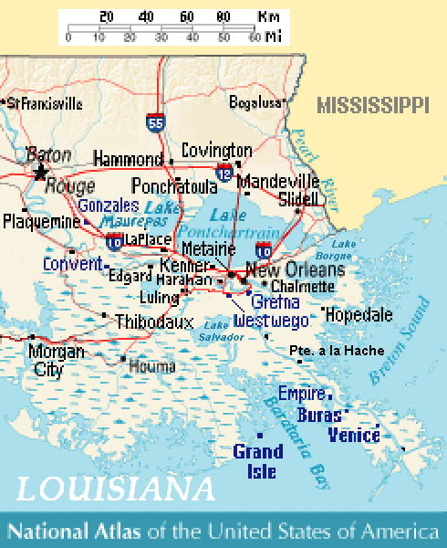
Close view of east-southeast Louisiana (USA), showing areas of Baton Rouge, New Orleans, Metairie, Chalmette, Gretna, Westwego, Harahan, Luling, Kenner, LaPlace, Edgard, Convent, Slidell, Mandeville, Covington, Ponchatoula, Empire, Buras, Venice, and Grand Isle, Louisiana. Lakes include: Lake Pontchartrain, Lake Maurepas (west), and Lake Salvador (south). |
|---|---|
| Source |
Except from National Atlas of the United States, with more towns labeled/clarified. |
| Date |
09-July-2007 |
| Author |
MyName (Wikid77) |
| Permission (Reusing this image) |
(see below) |
| Other versions | (none yet) |
[edit] References
-
- Louisiana-Map.org, webpage: LaMap-Louisiana-road-map (shows town/lake names).
| This map was obtained from an edition of the National Atlas of the United States. Like almost all works of the U.S. federal government, works from the National Atlas are in the public domain. Online access: NationalAtlas.gov | 1970 print edition: Library of Congress, Perry-Castañeda Library |
|
Historique du fichier
Cliquer sur une date et une heure pour voir le fichier tel qu’il était à ce moment-là
| Date et heure | Dimensions | Utilisateur | Commentaire | |
|---|---|---|---|---|
| actuel | 9 juillet 2007 à 16:08 | 490×600 (70 Kio) | Wikid77 | (added labels "en:Lake Borgne" & "Lake Salvador" + "Pte. a la Hache" ) |
| 9 juillet 2007 à 15:45 | 490×600 (69 Kio) | Wikid77 | (curved "LOUISIANA"; clarified "Lake"; spelling "Barataria Bay" was "Barararia") | |
| 9 juillet 2007 à 14:05 | 490×600 (69 Kio) | Wikid77 | ({{Information | Description= Close view of east-southeast Louisiana (USA), showing areas of Baton Rouge, New Orleans, Metairie, Chalmette, Gretna, Westwego, [[:en:) |
Pages contenant l’image
La page ci-dessous contient cette image :

