Image:Mountain meadows map5.jpg
Un article de Wikipédia, l'encyclopédie libre.
Taille de cet aperçu : 644 × 599 pixels
Image en plus haute résolution (909 × 846 pixels, taille du fichier : 176 Kio, type MIME : image/jpeg)
| | Ce fichier provient de Wikimedia Commons?. Les informations le concernant sont affichées ci-dessous (procédure). |
 It is recommended that the other file be used. Alemannisch | العربية | Български | Česky | Dansk | Deutsch | English | Ελληνικά | Esperanto | Español | Français | Galego | עברית | हिन्दी | Magyar | Bahasa Indonesia | Italiano | 日本語 | 한국어 | Lietuvių | Nederlands | Norsk (nynorsk) | Polski | Português | Română | Русский | Slovenščina | Српски / Srpski | Svenska | Türkçe | 中文(简体) | 中文(繁體) | +/- |
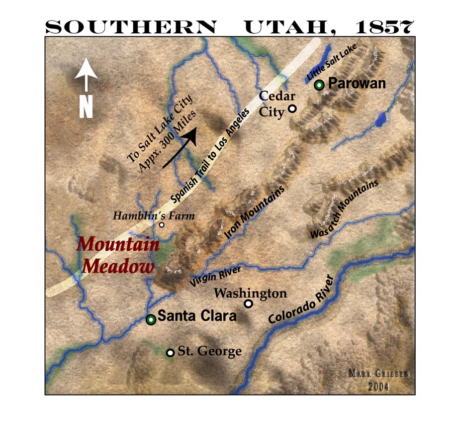
A 150-dpi JPEG Map of Southern Utah in 1857, highlighting the Mountain Meadows area including the Wasatch Mountains and Colorado River.
| This image has been released into the public domain by its author, marklemagne. This applies worldwide. In some countries this may not be legally possible; if so: العربية | Български | Deutsch | Ελληνικά | English | Español | Français | Italiano | 日本語 | 한국어 | Polski | Русский | Српски / Srpski | Svenska | தமிழ் | Українська | 中文(繁體) | 中文(简体) +/- |
Historique du fichier
Cliquer sur une date et une heure pour voir le fichier tel qu’il était à ce moment-là
| Date et heure | Dimensions | Utilisateur | Commentaire | |
|---|---|---|---|---|
| actuel | 13 mai 2005 à 05:46 | 909×846 (176 Kio) | Marklemagne | (A 150-dpi JPEG Map of Southern Utah in 1857, highlighting the Mountain Meadows area including the Wasatch Mountains and Colorado River. {{PD-user|marklemagne}}) |
Pages contenant l’image
La page ci-dessous contient cette image :

