Image:Mount Cayley.jpg
Un article de Wikipédia, l'encyclopédie libre.
Pas de plus haute résolution disponible.
Mount_Cayley.jpg (400 × 268 pixels, taille du fichier : 15 Kio, type MIME : image/jpeg)
| | Ce fichier provient de Wikimedia Commons?. Les informations le concernant sont affichées ci-dessous (procédure). |
| Description |
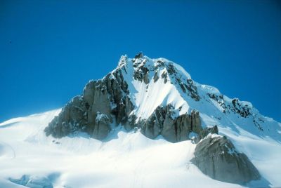
Michael Coyle, takes on a traverse of the Pemberton Icecap. Shows the mountain's southwest slopes. The easiest route to the summit follows the skyline ridge (with the cornices) en:Category:Volcanoes of Canada en:Category:Volcanoes of British Columbia en:Category:Cascade Volcanoes |
|---|---|
| Source |
Originally from en.wikipedia; description page is/was here. |
| Date |
2007-02-18 (original upload date) |
| Author |
Original uploader was Tsylos at en.wikipedia |
| Permission (Reusing this image) |
Released under the GNU Free Documentation License. |
[edit] License information

[edit] Original upload log
(All user names refer to en.wikipedia)
- 2007-02-18 01:51 Tsylos 400×268×8 (15168 bytes) Michael Coyle, takes on a traverse of the Pemberton Icecap. Shows the mountain's southwest slopes. The easiest route to the summit follows the skyline ridge (with the cornices)
Historique du fichier
Cliquer sur une date et une heure pour voir le fichier tel qu’il était à ce moment-là
| Date et heure | Dimensions | Utilisateur | Commentaire | |
|---|---|---|---|---|
| actuel | 25 avril 2007 à 14:45 | 400×268 (15 Kio) | Hike395 | ({{Information |Description=Michael Coyle, takes on a traverse of the Pemberton Icecap. Shows the mountain's southwest slopes. The easiest route to the summit follows the skyline ridge (with the cornices) en:Category:Volcanoes of Canada [[:en:Categor) |
Pages contenant l’image
La page ci-dessous contient cette image :

