Image:LocationSouthGeorgiaAndSouthSandwichIslands.png
Un article de Wikipédia, l'encyclopédie libre.
Pas de plus haute résolution disponible.
LocationSouthGeorgiaAndSouthSandwichIslands.png (250 × 115 pixels, taille du fichier : 5 Kio, type MIME : image/png)
| | Ce fichier provient de Wikimedia Commons?. Les informations le concernant sont affichées ci-dessous (procédure). |
[edit] Summary
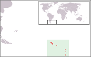
Location map of South Georgia and the South Sandwich Islands. Created by nl:User:Bemoeial based on GFDL-map of en:User:Vardion of Image:LocationFalklandIslands.png.
[edit] Licensing

Historique du fichier
Cliquer sur une date et une heure pour voir le fichier tel qu’il était à ce moment-là
| Date et heure | Dimensions | Utilisateur | Commentaire | |
|---|---|---|---|---|
| actuel | 26 septembre 2005 à 13:00 | 250×115 (5 Kio) | Bemoeial2 | (Location map of South Georgia and the South Sandwich Islands. Created by ;nl:Gebruiker:Bemoeial based on GFDL-map of en:User:Vardion of Image:LocationFalklandIslands.png. ) |
Pages contenant l’image
La page ci-dessous contient cette image :

