Image:Lake turkana satellite.jpg
Un article de Wikipédia, l'encyclopédie libre.
Taille de cet aperçu : 800 × 593 pixels
Image en plus haute résolution (992 × 735 pixels, taille du fichier : 166 Kio, type MIME : image/jpeg)
| | Ce fichier provient de Wikimedia Commons?. Les informations le concernant sont affichées ci-dessous (procédure). |
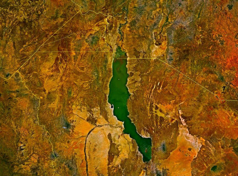
Lake Turkana, Kenya and Ethiopia. satellite image. The yellow lines denote the borders
| This image is in the public domain because it is a screenshot from NASA’s globe software World Wind using Blue Marble, Landsat or USGS layer, all of which are in public domain. |
|
Historique du fichier
Cliquer sur une date et une heure pour voir le fichier tel qu’il était à ce moment-là
| Date et heure | Dimensions | Utilisateur | Commentaire | |
|---|---|---|---|---|
| actuel | 24 mars 2006 à 02:09 | 992×735 (166 Kio) | Roke | (Lake Turkana, Kenya and Ethiopia. satellite image {{PD-WorldWind}} Category: Kenya) |
Pages contenant l’image
Les pages ci-dessous contiennent cette image :

