Image:Hurricane daniel 2006.jpg
Un article de Wikipédia, l'encyclopédie libre.
Taille de cet aperçu : 600 × 600 pixels
Image en plus haute résolution (4 320 × 4 320 pixels, taille du fichier : 3,41 Mio, type MIME : image/jpeg)
| | Ce fichier provient de Wikimedia Commons?. Les informations le concernant sont affichées ci-dessous (procédure). |
[edit] Summary
| Description |
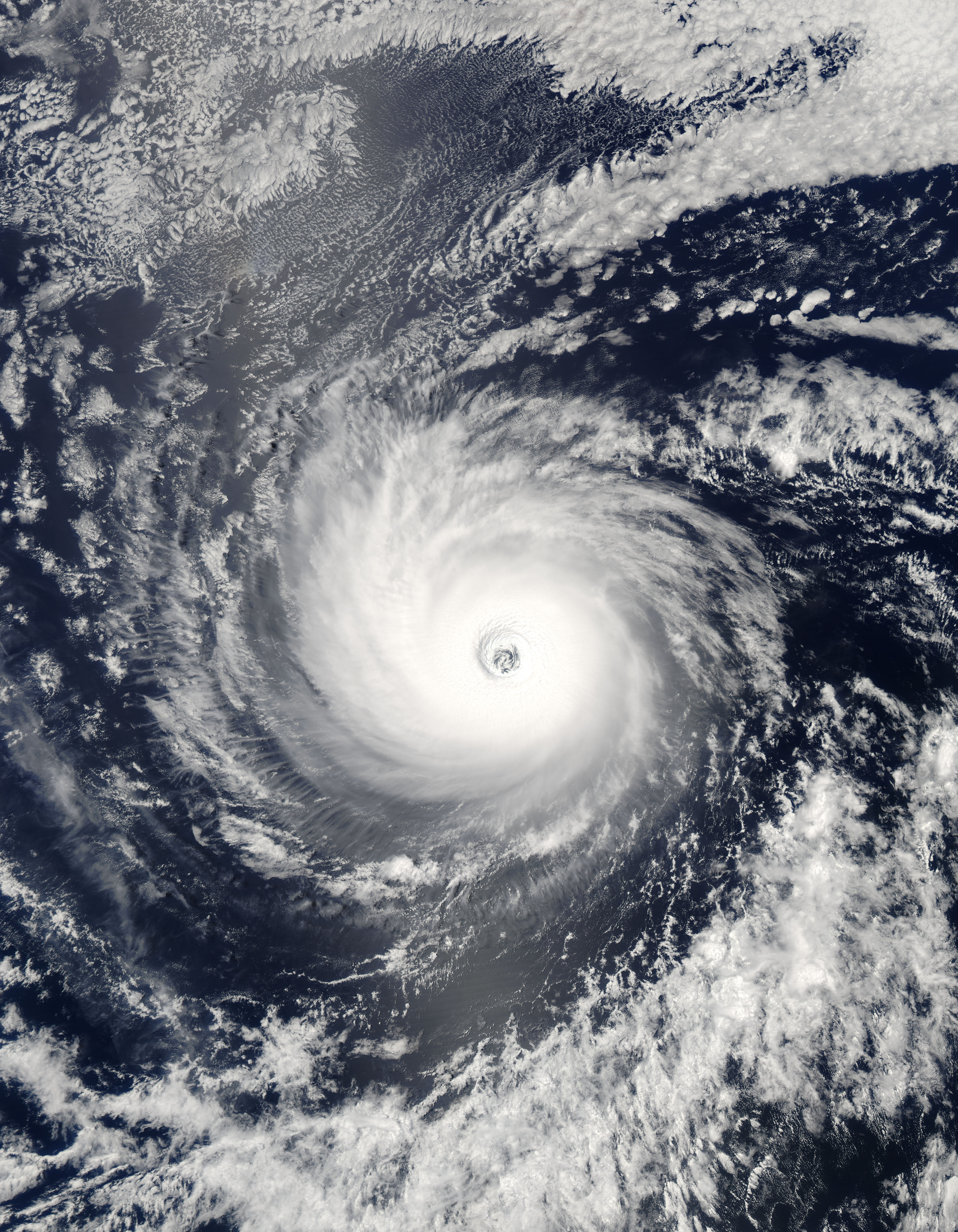
With winds near 240 kilometers per hour (150 miles per hour or 130 knots), Hurricane Daniel was a powerful and dangerous storm when the Moderate Resolution Imaging Spectroradiometer (MODIS) on NASA’s Aqua satellite captured this image on July 21, 2006, over the Eastern Pacific Ocean. Daniel has tightly spiraling clouds that circle an open eye with near-perfect symmetry: hallmarks of a well-organized storm. At the time, 2:55 p.m. Pacific Daylight Time (21:55 UTC), Daniel was a strong Category 4 storm, its winds just a few knots short of a Category 5 storm. The Central Pacific Hurricane Center predicted that the storm would move slowly northwest, gradually degrading into a tropical storm before hitting the island of Hawaii on July 28. The large image provided above has a resolution of 250 meters per pixel. |
|||||
|---|---|---|---|---|---|---|
| Source |
http://rapidfire.sci.gsfc.nasa.gov/gallery/?2006202-0721/Daniel.A2006202.2155 |
|||||
| Date |
2006-07-21 |
|||||
| Author |
NASA image courtesy Jeff Schmaltz, MODIS Land Rapid Response Team at NASA GSFC |
|||||
| Permission (Reusing this image) |
|

Historique du fichier
Cliquer sur une date et une heure pour voir le fichier tel qu’il était à ce moment-là
| Date et heure | Dimensions | Utilisateur | Commentaire | |
|---|---|---|---|---|
| actuel | 1 août 2006 à 18:42 | 4 320×4 320 (3,41 Mio) | Good kitty | |
| 24 juillet 2006 à 21:54 | 2 160×2 160 (1,43 Mio) | Good kitty | ||
| 20 juillet 2006 à 19:42 | 4 000×4 000 (2,98 Mio) | Good kitty | ( ) |
Pages contenant l’image
La page ci-dessous contient cette image :

