Image:HRR 1648.png
Un article de Wikipédia, l'encyclopédie libre.
Taille de cet aperçu : 647 × 600 pixels
Image en plus haute résolution (2 362 × 2 189 pixels, taille du fichier : 2,61 Mio, type MIME : image/png)
| | Ce fichier provient de Wikimedia Commons?. Les informations le concernant sont affichées ci-dessous (procédure). |
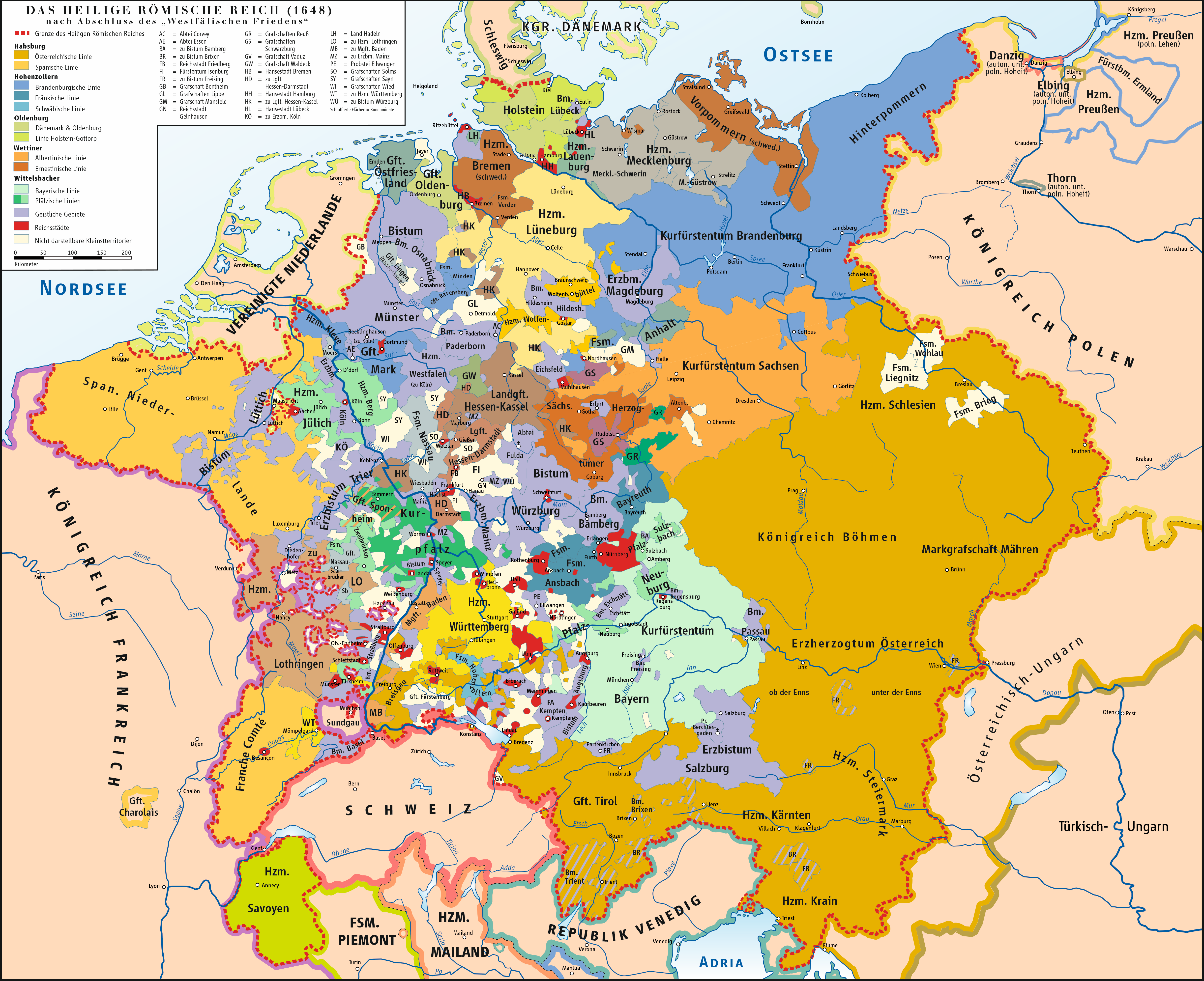
[edit] Beschreibung
| Description |
Karte des Heiligen Römischen Reiches 1648 / Map of Holy Roman Empire 1648 |
|---|---|
| Source |
own drawing/Source of Information: Putzger – Historischer Weltatlas, 89. Auflage, 1965 |
| Date |
2007-02-11 |
| Author | |
| Permission (Reusing this image) |
GNU FDL |
| Other versions | unknown |
[edit] Licensing
|

Historique du fichier
Cliquer sur une date et une heure pour voir le fichier tel qu’il était à ce moment-là
| Date et heure | Dimensions | Utilisateur | Commentaire | |
|---|---|---|---|---|
| actuel | 16 mai 2008 à 14:48 | 2 362×2 189 (2,61 Mio) | Kgberger | |
| 28 avril 2008 à 15:03 | 2 362×2 190 (2,6 Mio) | Kgberger | ||
| 17 mars 2008 à 14:02 | 2 362×2 189 (2,59 Mio) | Kgberger | ||
| 10 mars 2008 à 17:16 | 2 362×2 189 (2,58 Mio) | Kgberger | ||
| 10 mars 2008 à 17:11 | 4 842×4 488 (3,67 Mio) | Kgberger | ||
| 25 février 2008 à 17:08 | 2 362×2 189 (2,58 Mio) | Kgberger | ||
| 13 février 2008 à 20:00 | 2 362×2 190 (2,55 Mio) | Kgberger | ||
| 12 février 2008 à 12:50 | 2 362×2 189 (2,55 Mio) | Kgberger | ||
| 11 février 2008 à 14:10 | 2 362×2 189 (2,55 Mio) | Kgberger | (== Beschreibung == {{Information |Description=Karte des Heiligen Römischen Reiches 1648 / Map of Holy Roman Empire 1648 |Source=own drawing/Source of Information: Putzger – Historischer Weltatlas, 89. Auflage, 1965 |Date=2007-02-11 |Author=[[:de:Benutz) |
Pages contenant l’image
La page ci-dessous contient cette image :

