Image:Habsburg Map 1547.jpg
Un article de Wikipédia, l'encyclopédie libre.
Taille de cet aperçu : 800 × 498 pixels
Image en plus haute résolution (1 654 × 1 029 pixels, taille du fichier : 421 Kio, type MIME : image/jpeg)
| | Ce fichier provient de Wikimedia Commons?. Les informations le concernant sont affichées ci-dessous (procédure). |
[edit] Description
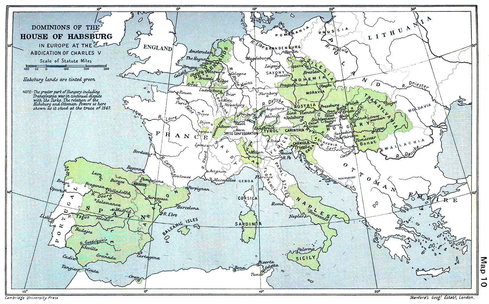
A map of the dominion of the Habsburgs following the Battle of Mühlberg (1547). Taken from The Cambridge Modern History Atlas, edited by Sir Adolphus William Ward, G.W. Prothero, Sir Stanley Mordaunt Leathes, and E.A. Benians. Cambridge University Press: London, 1912. A digitally clean up version of this map is "Habsburg Map 1547b.jpg"
[edit] Licensing
| This work is in the public domain in the United States because it was published before January 1, 1923.
Public domain works must be out of copyright in both the United States and in the source country of the work in order to be hosted on the Commons. If the work is not a U.S. work, the file must have an additional copyright tag indicating the copyright status in the source country. |
Historique du fichier
Cliquer sur une date et une heure pour voir le fichier tel qu’il était à ce moment-là
| Date et heure | Dimensions | Utilisateur | Commentaire | |
|---|---|---|---|---|
| actuel | 28 juin 2005 à 16:42 | 1 654×1 029 (421 Kio) | Rythin | (A map of the dominion of the Habsburgs following the Battle of Mühlberg (1547). Taken from ''The Cambridge Modern History Atlas,'' edited by Sir Adolphus William Ward, G.W. Prothero, Sir Stanley Mordaunt Leathes, and E.A. Benians. Cambridge University Pr) |
Pages contenant l’image
Les pages ci-dessous contiennent cette image :

