Image:Gwash map02.jpg
Un article de Wikipédia, l'encyclopédie libre.
Taille de cet aperçu : 800 × 593 pixels
Image en plus haute résolution (3 227 × 2 390 pixels, taille du fichier : 1,77 Mio, type MIME : image/jpeg)
| | Ce fichier provient de Wikimedia Commons?. Les informations le concernant sont affichées ci-dessous (procédure). |
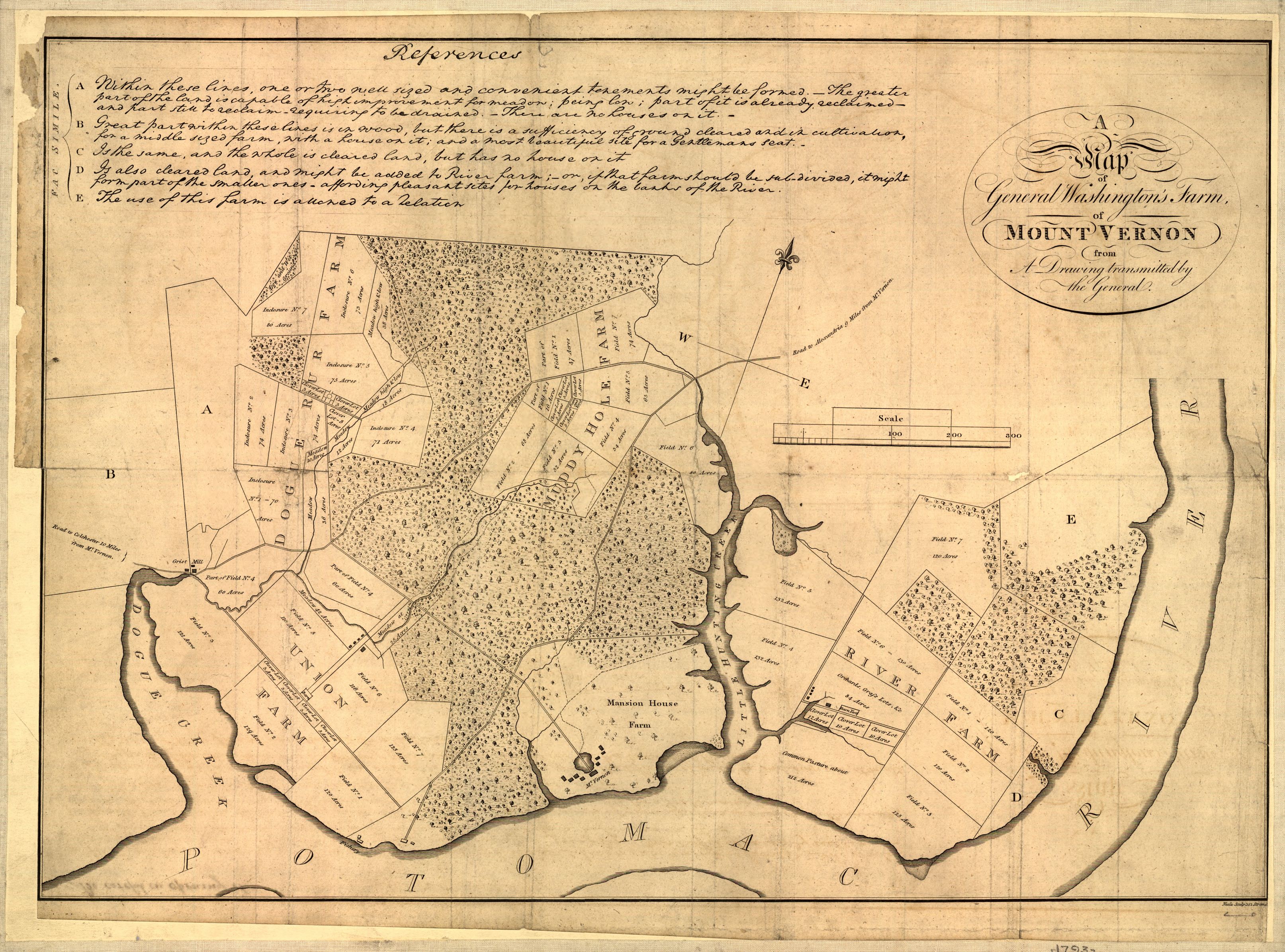
Map of Mount Vernon, residence of George Washington made by himself.
A map of General Washington's farm of Mount Vernon from a drawing transmitted by the General.
Uploaded from http://hdl.loc.gov/loc.gmd/g3882m.ct000367.
Notes from Library of Congress page:
CREATED/PUBLISHED [S.l., 1801]
NOTES Removed from: Letters from His Excellency George Washington, to Arthur Young, [etc.]. London, 1801. Opp. p. (E312.75.A27 Rare Book Rm.)
Scale 1:6,336.
SUBJECTS Mount Vernon (Va. : Estate)--Maps--Early works to 1800. United States--Virginia--Mount Vernon (Estate)
MEDIUM 1 map ; 37 x 52 cm.
CALL NUMBER G3882.M7 1793 .W34 1801 TIL Vault
REPOSITORY Library of Congress Geography and Map Division Washington, D.C. 20540-4650
DIGITAL ID g3882m ct000367
| This map is available from the United States Library of Congress's Geography & Map Division under the digital ID g3882m.ct000367 This tag does not indicate the copyright status of the attached work. A normal copyright tag is still required. See Commons:Licensing for more information. |
[edit] Licensing
| This image (or other media file) is in the public domain because its copyright has expired. This applies to the United States, Canada, the European Union and those countries with a copyright term of life of the author plus 70 years.
العربية | Asturianu | Български | Català | Česky | Dansk | Deutsch | English | Ελληνικά | Esperanto | Español | Euskara | فارسی | Français | Gaeilge | Galego | עברית | हिन्दी | Bahasa Indonesia | Italiano | 日本語 | 한국어 | Kurdî / كوردی | Lietuvių | Magyar | Nederlands | Norsk (nynorsk) | Македонски | Bahasa Melayu | Polski | Português | Română | Русский | Slovenčina | Slovenščina | Shqip | Suomi | Sámegiella | Türkçe | 中文(简体) | 中文(繁體) | 粵語 | +/- |
Historique du fichier
Cliquer sur une date et une heure pour voir le fichier tel qu’il était à ce moment-là
| Date et heure | Dimensions | Utilisateur | Commentaire | |
|---|---|---|---|---|
| actuel | 1 octobre 2006 à 04:17 | 3 227×2 390 (1,77 Mio) | Clindberg | (Reupload from http://hdl.loc.gov/loc.gmd/g3882m.ct000367 with higher resolution; change license (not USGov but is PD-old)) |
| 6 juin 2005 à 15:01 | 804×600 (138 Kio) | Herrick | (Map of Mount Vernon, residence of George Washington made by himself. A map of General Washington's farm of Mount Vernon from a drawing transmitted by the General. {{PD-USGov}} Washington, George, 1732-1799. CREATED/PUBLISHED [S.l., 1801] NOTES ) |
Pages contenant l’image
La page ci-dessous contient cette image :

