Image:Empress of Ireland wreck position.png
Un article de Wikipédia, l'encyclopédie libre.
Pas de plus haute résolution disponible.
Empress_of_Ireland_wreck_position.png (698 × 480 pixels, taille du fichier : 576 Kio, type MIME : image/png)
| | Ce fichier provient de Wikimedia Commons?. Les informations le concernant sont affichées ci-dessous (procédure). |
[edit] Description
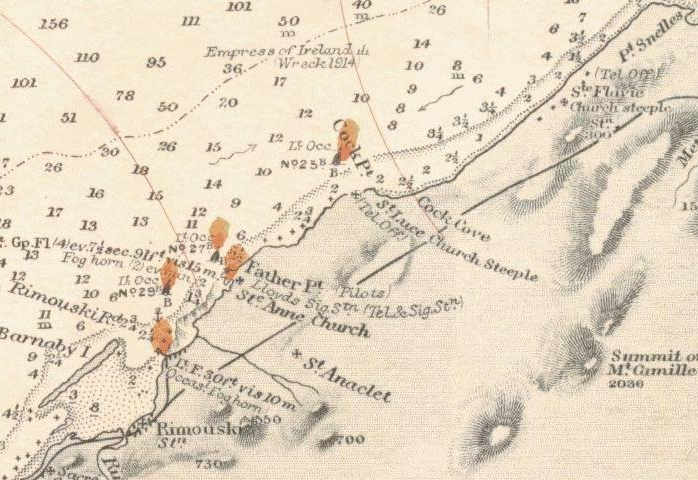
Part of nautical chart showing the position of the wreck Empress of Ireland. Near Pointe au Père (Father point). Near Rimouski. Site [1] Cart Nbr: 307 . Canada RIVER ST LAWRENCE WEST PT OF ANTICOSTI TO SAGUENAY RIVER
[edit] Licensing
| This image is in the public domain because it contains materials that originally came from the U.S. National Oceanic and Atmospheric Administration, taken or made during the course of an employee's official duties. |
|
Historique du fichier
Cliquer sur une date et une heure pour voir le fichier tel qu’il était à ce moment-là
| Date et heure | Dimensions | Utilisateur | Commentaire | |
|---|---|---|---|---|
| actuel | 8 juin 2007 à 16:32 | 698×480 (576 Kio) | Clipper | (Part of nautical chart showing the position of the wreck ''Empress of Ireland''. Near Pointe Saint Père (Father point). Near Rimouski. category:nautical chart) |
Pages contenant l’image
La page ci-dessous contient cette image :

