Image:Caspian Sea from orbit.jpg
Un article de Wikipédia, l'encyclopédie libre.
Taille de cet aperçu : 471 × 599 pixels
Image en plus haute résolution (550 × 700 pixels, taille du fichier : 67 Kio, type MIME : image/jpeg)
| | Ce fichier provient de Wikimedia Commons?. Les informations le concernant sont affichées ci-dessous (procédure). |
| Description |
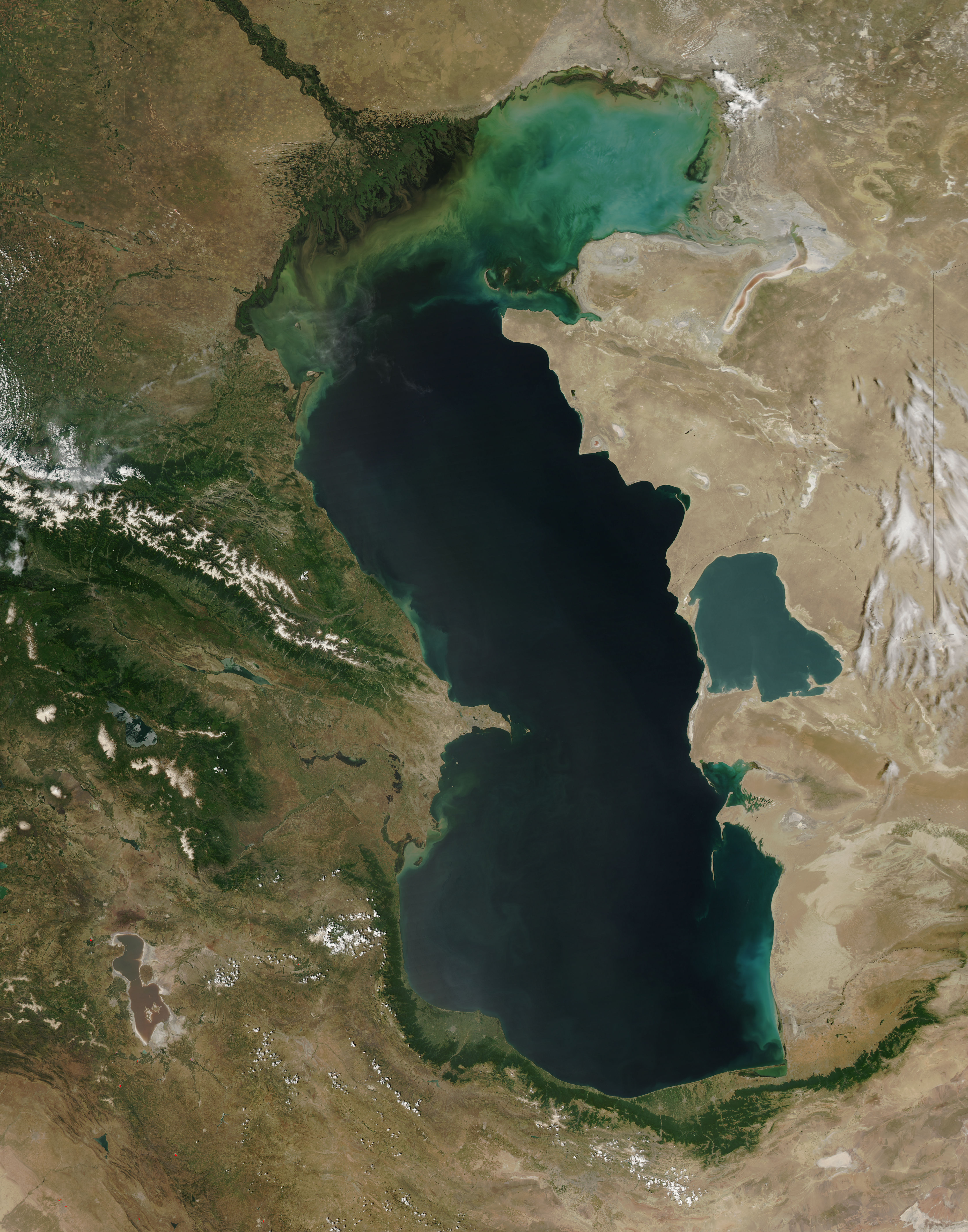
Español: El Mar Caspio visto desde la órbita terrestre
English: This is a view from orbit of the Caspian Sea as imaged by the MODIS sensor on the Terra satellite. Caption: The original caption from NASA: ::"The northern part of the Caspian Sea is plagued by a process called eutrophication, in which agricultural run-off rich in fertilizers stimulates rampant growth of algae in the water. The death and decay of these algae robs the water of oxygen, with obvious negative consequences for aquatic life. This image of the Caspian Sea shows swirls of green and blue near the mouth of the Volga River (top center), which indicate the presence of algae. The bright blue color of the northeastern part of the sea may be due to a mixture of plant life and sediment, for this is where the sea is most shallow. This image is from the Moderate Resolution Imaging Spectroradiometer (MODIS) on the Terra satellite on June 11, 2003.
|
|---|---|
| Source |
http://visibleearth.nasa.gov/view_rec.php?id=5514
|
| Date |
2003-06-11 |
| Author |
Jeff Schmaltz, MODIS Rapid Response Team, NASA/GSFC |
| Permission (Reusing this image) |
see below |
[edit] License
|
|
This file is in the public domain because it was created by NASA. NASA copyright policy states that "NASA material is not protected by copyright unless noted". (NASA copyright policy page or JPL Image Use Policy).
Deutsch | English | Español | Français | Nederlands | Português | Русский | 中文(简体) | 中文(繁體) | +/- |
|
 |
Warnings:
|
Historique du fichier
Cliquer sur une date et une heure pour voir le fichier tel qu’il était à ce moment-là
| Date et heure | Dimensions | Utilisateur | Commentaire | |
|---|---|---|---|---|
| actuel | 8 février 2005 à 17:10 | 550×700 (67 Kio) | Pixeltoo | (Caspian sea by space Nasa) |
Pages contenant l’image
Les pages ci-dessous contiennent cette image :

