Image:Cape breton island.png
Un article de Wikipédia, l'encyclopédie libre.
Pas de plus haute résolution disponible.
Cape_breton_island.png (514 × 562 pixels, taille du fichier : 16 Kio, type MIME : image/png)
| | Ce fichier provient de Wikimedia Commons?. Les informations le concernant sont affichées ci-dessous (procédure). |
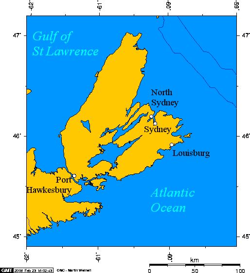
Cape Breton Island, Nova Scotia, Canada

en:User:Geo Swan used this online map creation tool to generate this map.
en:User:Geo Swan used the following longitude and latitude to the tool to specify the locations of the cities:
- -60.2524,46.2065,North Sydney
- -60.1955,46.1365,Sydney
- -59.9643,45.9235,Louisburg
- -61.3452,45.6119,Port Hawkesbury
Originally uploaded on 23 February 2005.
Historique du fichier
Cliquer sur une date et une heure pour voir le fichier tel qu’il était à ce moment-là
| Date et heure | Dimensions | Utilisateur | Commentaire | |
|---|---|---|---|---|
| actuel | 16 juin 2005 à 16:00 | 514×562 (16 Kio) | Peregrine981 | (Cape Breton Island, Nova Scotia, Canada {{GFDL}} en:User:Geo Swan used this [http://www.aquarius.geomar.de/omc/ online map creation tool] to generate this map. en:User:Geo Swan used the following longitude and latitude to the tool to specify t) |
Pages contenant l’image
La page ci-dessous contient cette image :

