Image:Côte d'Ivoire Map.jpg
Un article de Wikipédia, l'encyclopédie libre.
Taille de cet aperçu : 470 × 600 pixels
Image en plus haute résolution (1 036 × 1 322 pixels, taille du fichier : 440 Kio, type MIME : image/jpeg)
| | Ce fichier provient de Wikimedia Commons?. Les informations le concernant sont affichées ci-dessous (procédure). |
| Description |
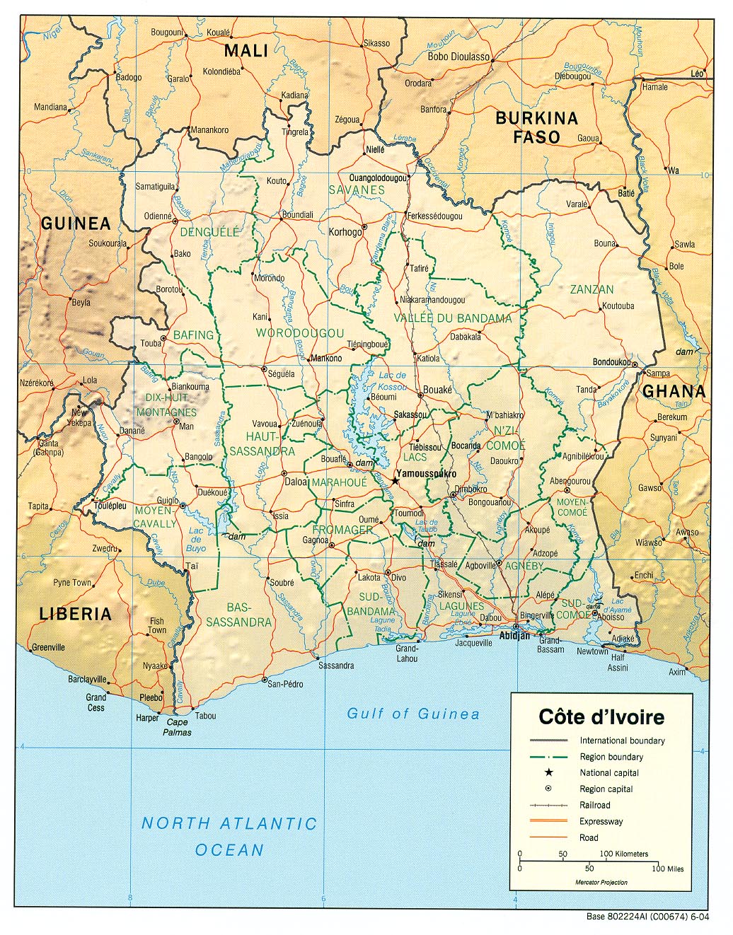
English: haded relief map of Côte d'Ivoire.
|
|||
|---|---|---|---|---|
| Source |
[1] from the Perry-Castañeda Library Map Collection. |
|||
| Date |
2004 |
|||
| Author |
CIA |
|||
| Permission (Reusing this image) |
|

Historique du fichier
Cliquer sur une date et une heure pour voir le fichier tel qu’il était à ce moment-là
| Date et heure | Dimensions | Utilisateur | Commentaire | |
|---|---|---|---|---|
| actuel | 21 février 2006 à 13:11 | 1 036×1 322 (440 Kio) | Lupo | (Shaded relief map of Côte d'Ivoire. Source: [http://www.lib.utexas.edu/maps/africa/cote_divoire_rel04.jpg] from the [http://www.lib.utexas.edu/maps/cote_d'ivoire.html Perry-Castañeda Library Map Collection]. {{PD-USGov-CIA}} [[Category:Maps of C�) |
Pages contenant l’image
Aucune page ne contient cette image.
Métadonnées
Ce fichier contient des informations supplémentaires probablement ajoutées par l’appareil photo numérique ou le numériseur qui l’a acquis. Si le fichier a été modifié depuis son état original, certains détails peuvent ne pas refléter entièrement l’image modifiée.
| Orientation | Normale |
|---|---|
| Résolution horizontale | 150 dpi |
| Résolution verticale | 150 dpi |
| Logiciel utilisé | Adobe Photoshop 7.0 |
| Date de modification | 27 septembre 2004 à 15:33 |
| Espace colorimétrique | 65535 |


![[1]](http://www.lib.utexas.edu/maps/africa/cote_divoire_rel04.jpg)