Image:Breakup of Yugoslavia.gif
Un article de Wikipédia, l'encyclopédie libre.
Pas de plus haute résolution disponible.
Breakup_of_Yugoslavia.gif (500 × 438 pixels, taille du fichier : 94 Kio, type MIME : image/gif)
| | Ce fichier provient de Wikimedia Commons?. Les informations le concernant sont affichées ci-dessous (procédure). |
| Description |
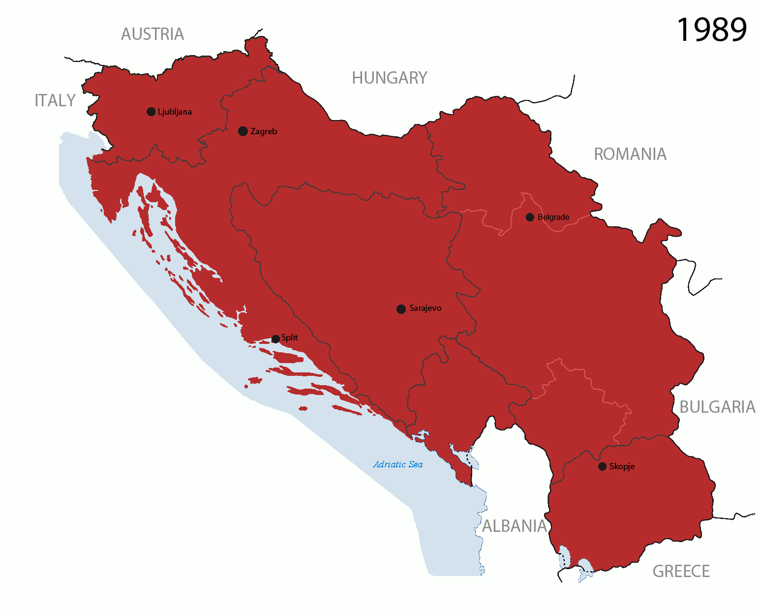
This is an animated GIF that shows the stages of the breakup of the SFR Yugoslavia in the 90's and 2000's. The map based off Morwen's map of the divisions of the SFRY, Which is licensed by the GFDL. The source for the dates of independence is the CIA World Factbook. These maps Since the original map was GFDL, this image is as well.
Here are some changes in this new build of the map:
Changelog for version 4:
Key: ██ Socialist Federal Republic of Yugoslavia (1943-1992) ██ Federal Republic of Yugoslavia (1992-2003), Serbia and Montenegro (2003-2006), Serbia (2006-) ██ Slovenia (1991-) ██ Croatia (1991-) ██ FYR Macedonia (1991-) ██ Bosnia and Herzegovina (1992-) ██ Inter-Entity Boundary Line (IEBL): Federation of Bosnia and Herzegovina and Republika Srpska (1995-) ██ Kosovo (under UNMIK control; 1999-) ██ Montenegro (2006-) |
|---|---|
| Source |
Made by Hoshie; see above for more details on sources. |
| Date |
24 July 2006 (orginal upload date) |
| Author | |
| Permission (Reusing this image) |
See below. |
[edit] Licensing

Historique du fichier
Cliquer sur une date et une heure pour voir le fichier tel qu’il était à ce moment-là
| Date et heure | Dimensions | Utilisateur | Commentaire | |
|---|---|---|---|---|
| actuel | 5 avril 2008 à 09:20 | 500×438 (94 Kio) | Hoshie | (Speed adjestments, pre 2008 Kosovo fixed) |
| 6 mars 2008 à 03:52 | 500×438 (83 Kio) | Hoshie | (non-Kosovo version until a consensus can be reached) | |
| 4 mars 2008 à 23:11 | 371×330 (46 Kio) | Bože pravde | (Reverted to version as of 09:29, 25 January 2007) | |
| 24 février 2008 à 04:50 | 500×438 (93 Kio) | Hoshie | (v4 is here! See changelog) | |
| 25 janvier 2007 à 11:29 | 371×330 (46 Kio) | Hoshie | (V. 3 of map more details to come.) | |
| 28 novembre 2006 à 10:03 | 350×311 (43 Kio) | Hoshie | (Updated the map to show the SFRY separate from the FRY and Kosovo is the same color as the rest of the FRY/SCG/Serbia.) | |
| 1 octobre 2006 à 09:28 | 278×247 (35 Kio) | Hoshie | (I have deleted the bounderies of the Federation of Bosnia and Herzegovina, the Brčko District, the Republika Srpska, plus Kosovo,since they are on a different level than the nations themselves. ) | |
| 30 septembre 2006 à 10:05 | 278×247 (33 Kio) | Hoshie | (I have made big changes to the map.) | |
| 8 août 2006 à 09:02 | 325×288 (62 Kio) | Hoshie | (I have made the dates smaller, removed Vojvodina, and changed the shade of Kosovo and Slovenia.) | |
| 30 juillet 2006 à 08:03 | 325×288 (47 Kio) | Hoshie | (The image has been updated to add the IEBL and the entries that divide it. Colors have been improved as well. This is still under the GFDL.) | |
| 24 juillet 2006 à 07:54 | 228×202 (48 Kio) | Hoshie | (==Summary== This is an animated GIF that shows the stages of the breakup of the SFR of Yugoslavia in the 90's and 2000's. The map based off [User:Morwen|Morwen]]'s map of the divisions of the SFRY, Which is licensed by) |
Pages contenant l’image
La page ci-dessous contient cette image :

