Image:Boisdesiouxrivermap.png
Un article de Wikipédia, l'encyclopédie libre.
Pas de plus haute résolution disponible.
Boisdesiouxrivermap.png (500 × 499 pixels, taille du fichier : 136 Kio, type MIME : image/png)
| | Ce fichier provient de Wikimedia Commons?. Les informations le concernant sont affichées ci-dessous (procédure). |
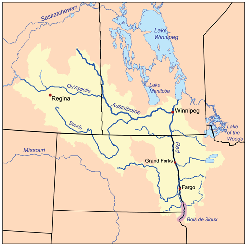
This is a map of the Red River of the North drainage basin, with the Bois de Sioux River highlighted. I, Karl Musser, created it based on USGS and Digital Chart of the World data.
|
Historique du fichier
Cliquer sur une date et une heure pour voir le fichier tel qu’il était à ce moment-là
| Date et heure | Dimensions | Utilisateur | Commentaire | |
|---|---|---|---|---|
| actuel | 15 février 2007 à 18:25 | 500×499 (136 Kio) | Kmusser | (This is a map of the Red River of the North drainage basin, with the Bois de Sioux River highlighted. I, Karl Musser, created it based on USGS and [[:en:Digital C) |
Pages contenant l’image
La page ci-dessous contient cette image :

