Image:Bcamazonica.jpg
Un article de Wikipédia, l'encyclopédie libre.
Pas de plus haute résolution disponible.
Bcamazonica.jpg (800 × 578 pixels, taille du fichier : 260 Kio, type MIME : image/jpeg)
| | Ce fichier provient de Wikimedia Commons?. Les informations le concernant sont affichées ci-dessous (procédure). |
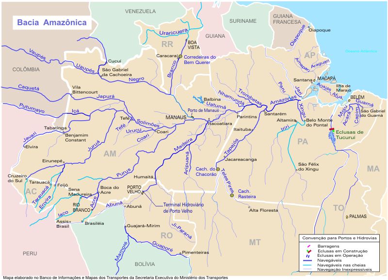
- Description
pt: O mapa mostra a região hidrográfica do Amazonas
en: Map showing the Amazonas watershed
- Source
http://www.transportes.gov.br/bit/mapas/mapclick/hidro/bcamaz.htm
 |
The copyright holder of this work allows anyone to use it for any purpose including unrestricted redistribution, commercial use, and modification.
Note: العربية | Asturianu | Български | Česky | Dansk | Deutsch | English | Esperanto | Español | فارسی | Français | Galego | Italiano | 日本語 | 한국어 | Kurdî / كوردی | Nederlands | Polski | Português | Русский | Suomi | Svenska | Türkçe | Shqip | 中文(简体) | 中文(繁體) | 粵語 | +/- |
Historique du fichier
Cliquer sur une date et une heure pour voir le fichier tel qu’il était à ce moment-là
| Date et heure | Dimensions | Utilisateur | Commentaire | |
|---|---|---|---|---|
| actuel | 18 avril 2005 à 20:19 | 800×578 (260 Kio) | Santana-freitas | (Região Hidrográfica do Amazonas) |
Pages contenant l’image
La page ci-dessous contient cette image :

