Image:Angola Map.jpg
Un article de Wikipédia, l'encyclopédie libre.
Taille de cet aperçu : 482 × 599 pixels
Image en plus haute résolution (1 030 × 1 280 pixels, taille du fichier : 283 Kio, type MIME : image/jpeg)
| | Ce fichier provient de Wikimedia Commons?. Les informations le concernant sont affichées ci-dessous (procédure). |
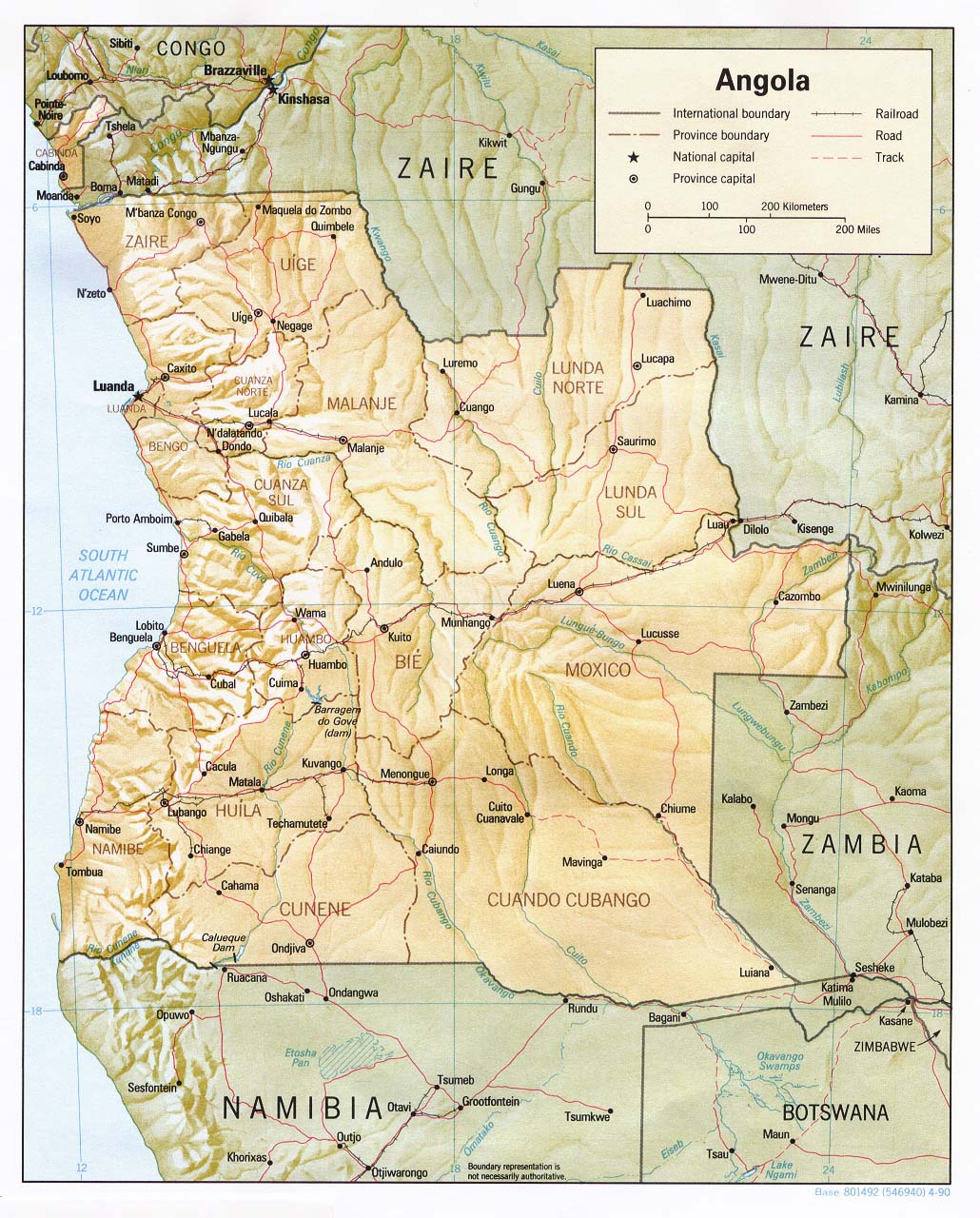
| Description |
English: Shaded relief map of Angola.
|
|||
|---|---|---|---|---|
| Source |
[1] from the Perry-Castañeda Library Map Collection. |
|||
| Date |
1990 |
|||
| Author |
CIA |
|||
| Permission (Reusing this image) |
|

Historique du fichier
Cliquer sur une date et une heure pour voir le fichier tel qu’il était à ce moment-là
| Date et heure | Dimensions | Utilisateur | Commentaire | |
|---|---|---|---|---|
| actuel | 21 février 2006 à 13:32 | 1 030×1 280 (283 Kio) | Lupo | (Shaded relief map of Angola. Source: [http://www.lib.utexas.edu/maps/africa/angola_rel90.jpg] from the [http://www.lib.utexas.edu/maps/angola.html Perry-Castañeda Library Map Collection]. {{PD-USGov-CIA}} Category:Maps of Angola) |
Pages contenant l’image
La page ci-dessous contient cette image :


![[1]](http://www.lib.utexas.edu/maps/africa/angola_rel90.jpg)