Image:1815 tambora explosion B.png
Un article de Wikipédia, l'encyclopédie libre.
Taille de cet aperçu : 800 × 358 pixels
Image en plus haute résolution (1 200 × 537 pixels, taille du fichier : 247 Kio, type MIME : image/png)
| | Ce fichier provient de Wikimedia Commons?. Les informations le concernant sont affichées ci-dessous (procédure). |
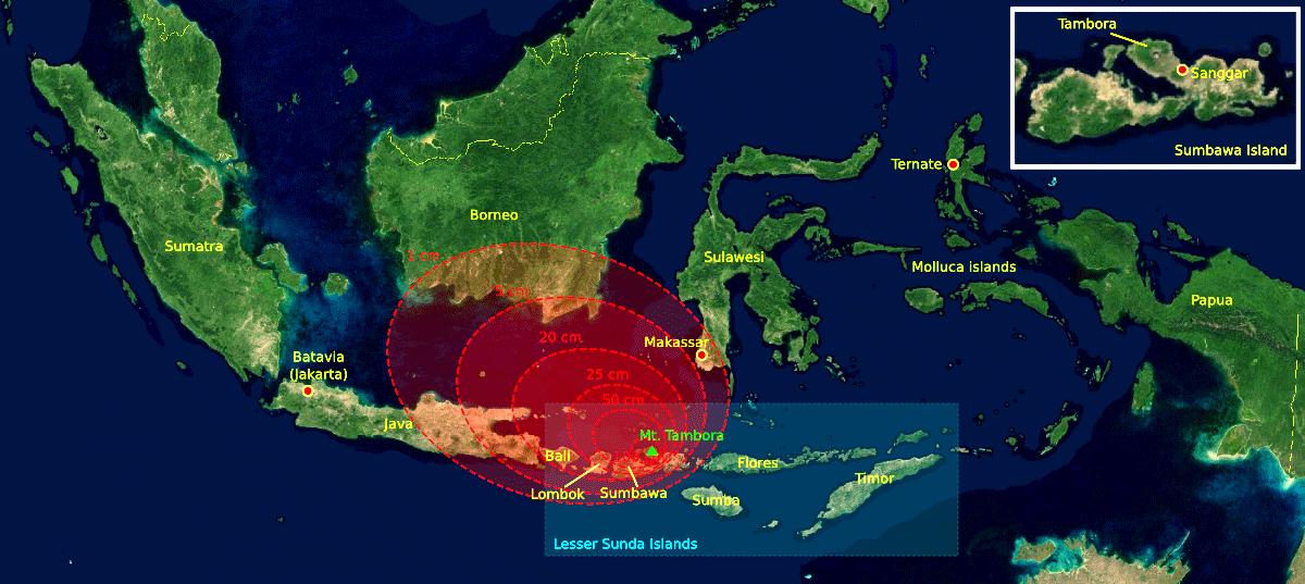
| Description |
The 1815 Mount Tambora eruption. The red areas are maps of the thickness of volcanic ashfall. |
|---|---|
| Source |
The base map was taken from NASA picture Image:Indonesia_BMNG.png and the isopach maps were traced from Oppenheimer (2003).[1] |
| Date | |
| Author |
myself |
| Permission (Reusing this image) |
|
| Other versions | 1815_tambora_explosion.png=Original (This version was modified by Xavax 16:44, 5 September 2007 (UTC)) |

[edit] References
- ↑ Oppenheimer, Clive (2003). "Climatic, environmental and human consequences of the largest known historic eruption: Tambora volcano (Indonesia) 1815". Progress in Physical Geography 27 (2): 230-259.
Historique du fichier
Cliquer sur une date et une heure pour voir le fichier tel qu’il était à ce moment-là
| Date et heure | Dimensions | Utilisateur | Commentaire | |
|---|---|---|---|---|
| actuel | 5 septembre 2007 à 18:44 | 1 200×537 (247 Kio) | Xavax | ({{Information |Description= The 1815 Mount Tambora eruption. The red areas are maps of the thickness of volcanic ashfall. |Source=The base map was taken from NASA picture Image:Indonesia_BMNG.png and the isopach maps were traced ) |

