Image:1759 map Holy Land and 12 Tribes.jpg
Un article de Wikipédia, l'encyclopédie libre.
Taille de cet aperçu : 715 × 599 pixels
Image en plus haute résolution (2 000 × 1 676 pixels, taille du fichier : 1,74 Mio, type MIME : image/jpeg)
| | Ce fichier provient de Wikimedia Commons?. Les informations le concernant sont affichées ci-dessous (procédure). |
[edit] Summary
Source: Geography and Map Division, Library of Congress [1]
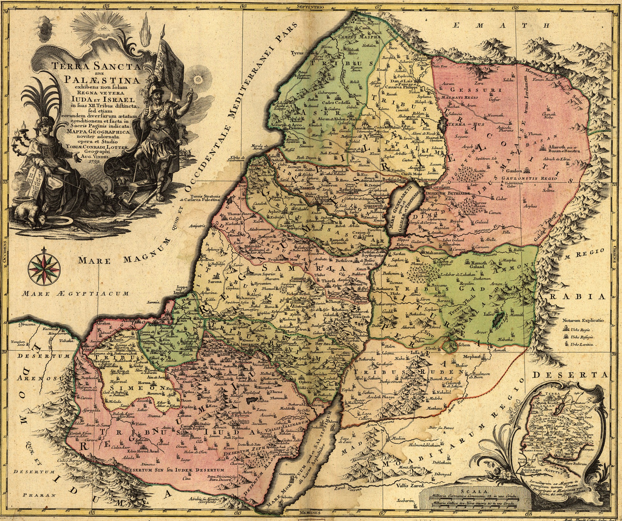
Terra Sancta sive Palæstina exhibens non solum Regna vetera Iuda et Israel in suas XII Tribus distincta, sed etiam eorundem diversarum ætatum conditionem et facta in Sacris Paginis indicata.
Lotter, Tobias Conrad, 1717-1777.
CREATED/PUBLISHED [S.l.], 1759.
NOTES Scale [ca. 1:695,000]. English Translation: The Holy Land or Palestine Showing not only the Old Kingdoms of Judea and Israel but also the 12 Tribes Distinctly, Confirming their Locations Diversely in their Ancient Condition and Doing So as the Holy Scriptures Indicate
SUBJECTS Palestine--Maps. Palestine.
MEDIUM 1 map : hand col. ; 47 x 57 cm.
CALL NUMBER G7500 1759 .L6 TIL
REPOSITORY Library of Congress Geography and Map Division Washington, D.C. 20540-4650
DIGITAL ID g7500 ct000391 [2]
Converted, reduced from 5.7MB SID image
| Creator/Artist | ||
|---|---|---|
| Name |
Lotter, Tobias
|
|
| Alternative names |
Lotter, Tobias Conrad / Lotter, Tobias Konrad
|
|
| Date of birth/death | 1717 | 1777 |
| Work location |
Augsburg
|
|
[edit] Licensing
| This image (or other media file) is in the public domain because its copyright has expired. This applies to the United States, Canada, the European Union and those countries with a copyright term of life of the author plus 70 years.
العربية | Asturianu | Български | Català | Česky | Dansk | Deutsch | English | Ελληνικά | Esperanto | Español | Euskara | فارسی | Français | Gaeilge | Galego | עברית | हिन्दी | Bahasa Indonesia | Italiano | 日本語 | 한국어 | Kurdî / كوردی | Lietuvių | Magyar | Nederlands | Norsk (nynorsk) | Македонски | Bahasa Melayu | Polski | Português | Română | Русский | Slovenčina | Slovenščina | Shqip | Suomi | Sámegiella | Türkçe | 中文(简体) | 中文(繁體) | 粵語 | +/- |
Historique du fichier
Cliquer sur une date et une heure pour voir le fichier tel qu’il était à ce moment-là
| Date et heure | Dimensions | Utilisateur | Commentaire | |
|---|---|---|---|---|
| actuel | 12 septembre 2005 à 12:43 | 2 000×1 676 (1,74 Mio) | Humus sapiens | (1759 map: Terra Sancta sive Palæstina exhibens no folum Regna vetera Iuda et Israel in fuas XII Tribus diftincta... Source: Library of Congress historical maps Category:Historical maps of the Middle East Category:Israel ) |
Pages contenant l’image
Les pages ci-dessous contiennent cette image :

