Image:Satellite image of Japan in May 2003.jpg
Un article de Wikipédia, l'encyclopédie libre.
Taille de cet aperçu : 483 × 600 pixels
Image en plus haute résolution (5 800 × 7 200 pixels, taille du fichier : 3,69 Mio, type MIME : image/jpeg)
| | Ce fichier provient de Wikimedia Commons?. Les informations le concernant sont affichées ci-dessous (procédure). |
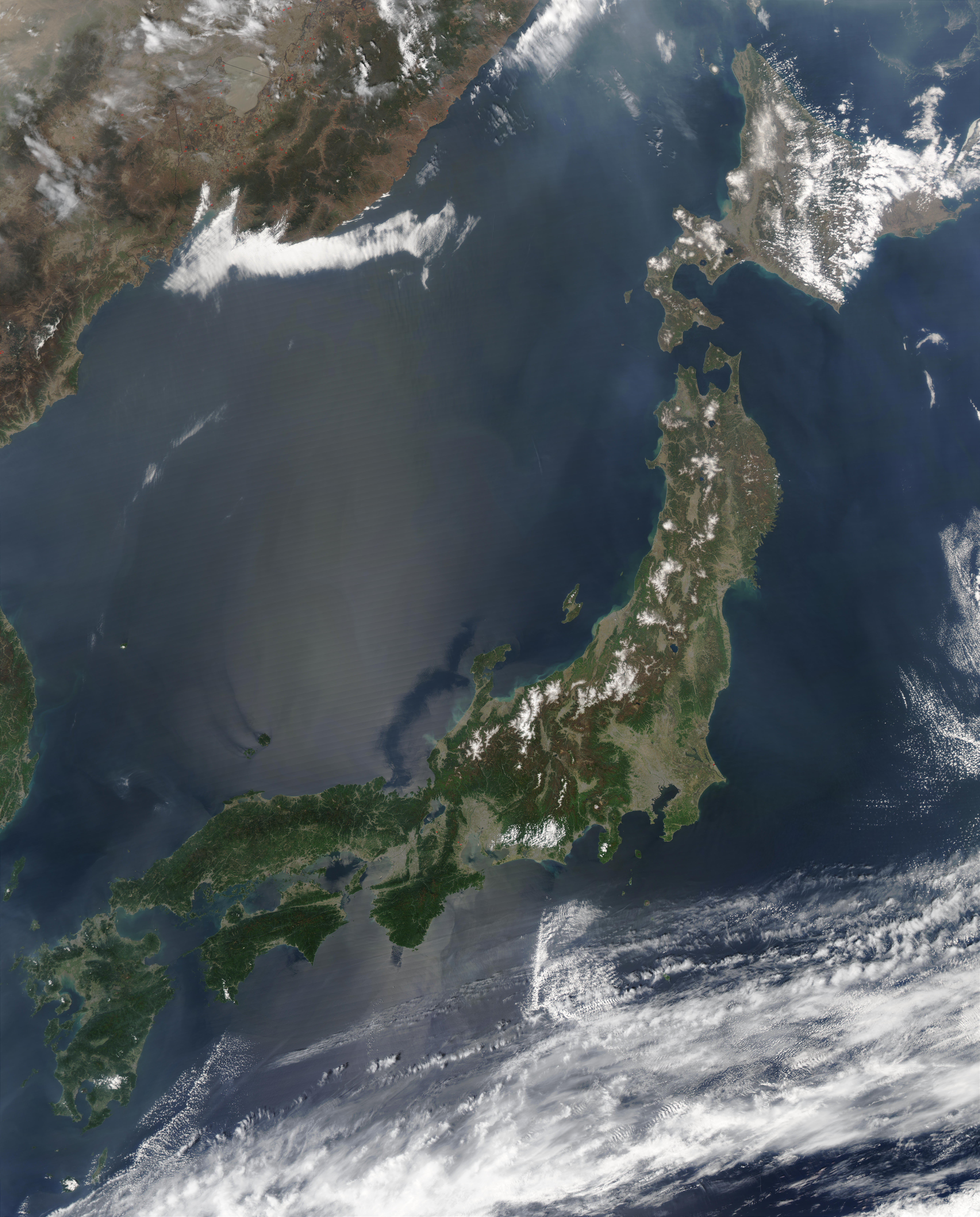
| Description |
Satellite image of Japan in May 2003.
|
|---|---|
| Source |
Cropped from http://visibleearth.nasa.gov/view_rec.php?id=5319 |
| Date |
May 1, 2003 |
| Author |
Jeff Schmaltz, MODIS Rapid Response Team, NASA/GSFC |
| Permission (Reusing this image) |
see below |
[edit] Licensing
|
|
This file is in the public domain because it was created by NASA. NASA copyright policy states that "NASA material is not protected by copyright unless noted". (NASA copyright policy page or JPL Image Use Policy).
Deutsch | English | Español | Français | Nederlands | Português | Русский | 中文(简体) | 中文(繁體) | +/- |
|
 |
Warnings:
|
Historique du fichier
Cliquer sur une date et une heure pour voir le fichier tel qu’il était à ce moment-là
| Date et heure | Dimensions | Utilisateur | Commentaire | |
|---|---|---|---|---|
| actuel | 31 mars 2006 à 12:41 | 5 800×7 200 (3,69 Mio) | Hautala | (higher resolution) |
| 25 décembre 2004 à 16:55 | 2 900×3 600 (1,29 Mio) | Hautala | ({{PD-USGov-NASA}} Satellite image of Japan in May 2003. Taken from NASA's Visible Earth http://visibleearth.nasa.gov/cgi-bin/viewrecord?25391 . The islands of Japan are shown clearly off the coast of North and South Korea, China, and Russia in this true-) |
Pages contenant l’image
Les pages ci-dessous contiennent cette image :

