Image:POLSKA mapa woj z powiatami.png
Un article de Wikipédia, l'encyclopédie libre.
Taille de cet aperçu : 646 × 600 pixels
Image en plus haute résolution (1 021 × 948 pixels, taille du fichier : 467 Kio, type MIME : image/png)
| | Ce fichier provient de Wikimedia Commons?. Les informations le concernant sont affichées ci-dessous (procédure). |
[edit] Summary
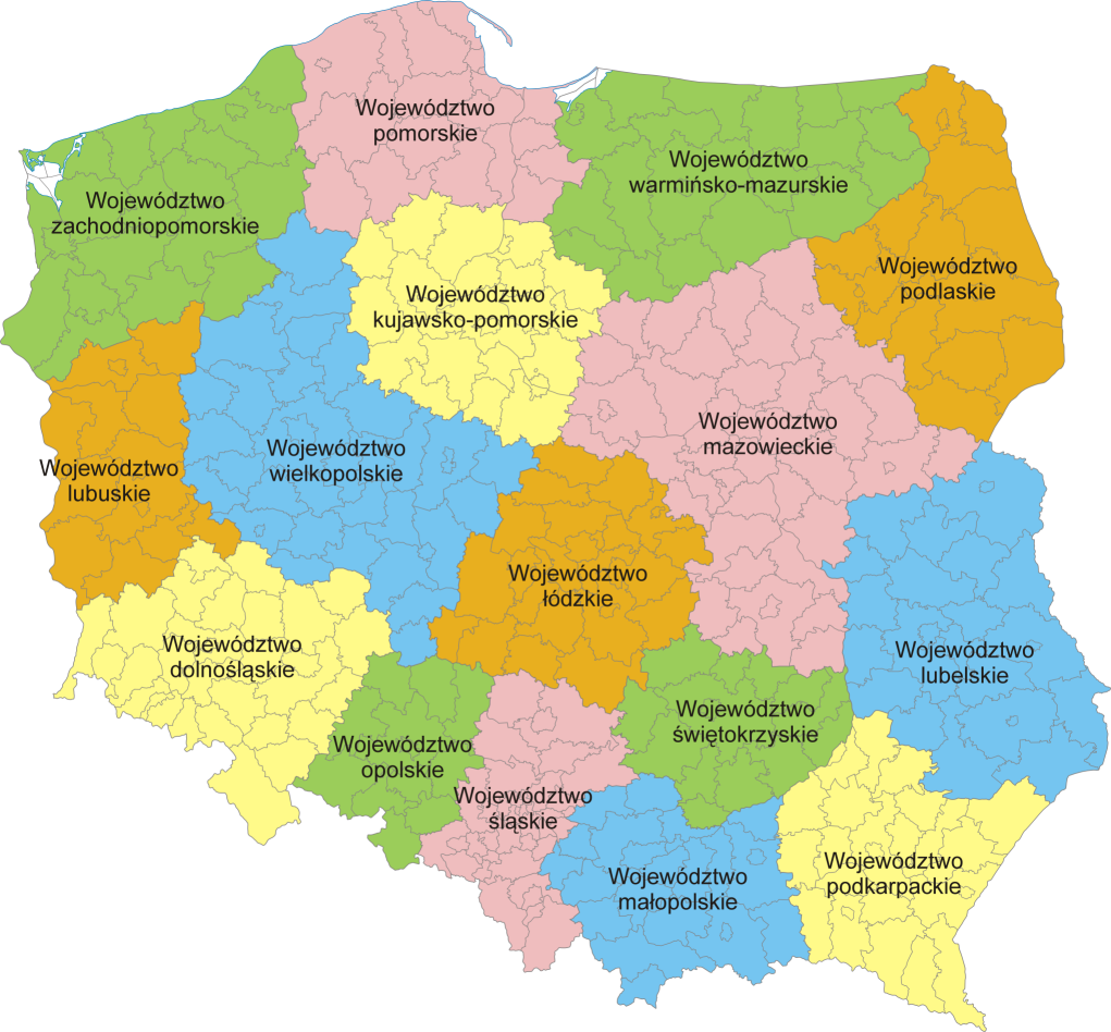
Mapa administracyjna Polski z zaznaczonymi granicami województw i powiatów, stan na 1 stycznia 2007. Autor: Aotearoa
Administrative map of Poland with borders of województwa (voivodships) and powiaty (counties), as of January 1, 2007. By Aotearoa
 |
This map image should be recreated using vector graphics as an SVG file. This has several advantages; see Commons:Media for cleanup for more information. If an SVG form of this image is already available, please upload it. After uploading an SVG, replace this template with template {{Vector version available|new image name.svg}} in this image. |
|
العربية | Български | Català | Česky | Dansk | Deutsch | English | Esperanto | Español | Français | 한국어 | Italiano | Magyar | Lietuvių | Nederlands | 日本語 | Polski | Português | Română | Русский | Suomi | Svenska | Türkçe | Українська | Tiếng Việt | मराठी | 中文(繁體) | 中文(简体) | +/- |
|
[edit] Licensing
|

Historique du fichier
Cliquer sur une date et une heure pour voir le fichier tel qu’il était à ce moment-là
| Date et heure | Dimensions | Utilisateur | Commentaire | |
|---|---|---|---|---|
| actuel | 5 février 2007 à 22:37 | 1 021×948 (467 Kio) | Aotearoa | (Mapa administracyjna Polski z zaznaczonymi granicami województw i powiatów, stan na 1 stycznia 2007. Autor: Aotearoa<br> Administrative map of Poland with borders of województwa (voivodships) and powiaty (counties), as of January 1, 2) |
Pages contenant l’image
La page ci-dessous contient cette image :

