Image:Map of Finland with provinces (numbered).png
Un article de Wikipédia, l'encyclopédie libre.
Pas de plus haute résolution disponible.
Map_of_Finland_with_provinces_(numbered).png (150 × 260 pixels, taille du fichier : 2 Kio, type MIME : image/png)
| | Ce fichier provient de Wikimedia Commons?. Les informations le concernant sont affichées ci-dessous (procédure). |
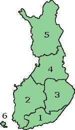
Map of Finland with the Province lines visible (numbered)
(c) adrian.benko, 2005, based on images by (c) helix84, 2005, based on images by (c) Jani Niemenmaa, 2003

Historique du fichier
Cliquer sur une date et une heure pour voir le fichier tel qu’il était à ce moment-là
| Date et heure | Dimensions | Utilisateur | Commentaire | |
|---|---|---|---|---|
| actuel | 12 octobre 2007 à 17:37 | 150×260 (2 Kio) | Skies | (Map of Finland with the Province lines visible (numbered) (c) adrian.benko, 2005, based on images by (c) helix84, 2005, based on images by (c) Jani Niemenmaa, 2003 {{GFDL}} [[Category:Locator m) |
| 12 octobre 2007 à 17:34 | 150×260 (2 Kio) | Skies | (Map of Finland with the Province lines visible (numbered) (c) adrian.benko, 2005, based on images by (c) helix84, 2005, based on images by (c) Jani Niemenmaa, 2003 {{GFDL}} [[Category:Locator m) | |
| 27 avril 2005 à 20:32 | 150×261 (17 Kio) | Adrian.benko | (Map of Finland with the Province lines visible (numbered) (c) User:adrian.benko, 2005, based on images by (c) helix84, 2005, based on images by (c) Jani Niemenmaa, 2003 {{GFDL}}) |
Pages contenant l’image
Les pages ci-dessous contiennent cette image :


.png)
.png)